
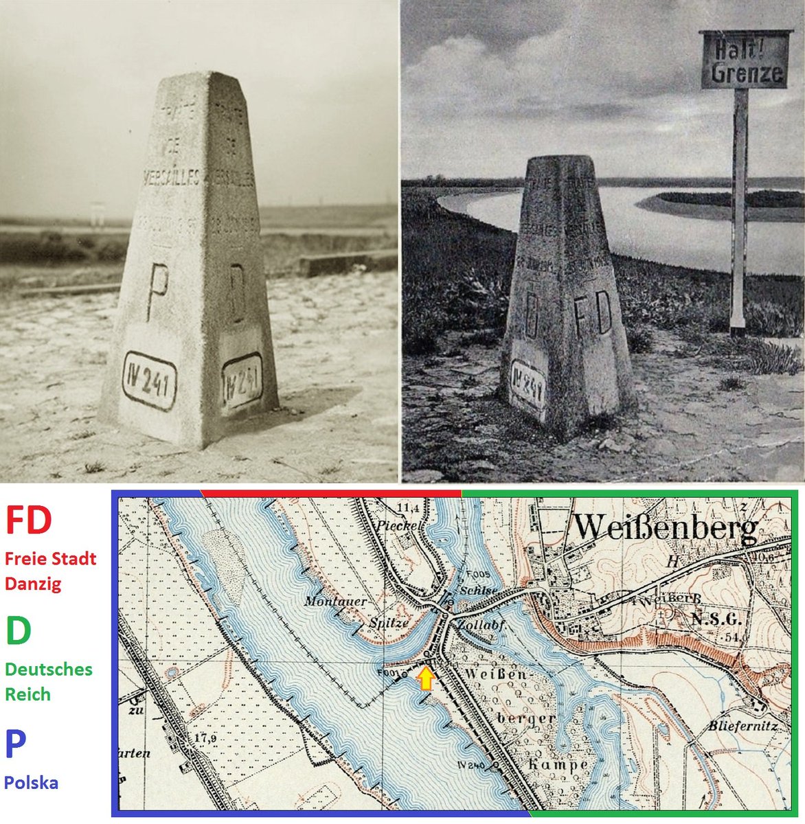
2⃣ Border marker of the tripoint of Danzig, Germany and Poland.
#Danzig #Gdańsk https://t.co/XrAPQL3EUD

Like many Asian nations during World War II, the Vietnamese were mistreated by Imperial Japan. Japan occupied French https://t.co/KEXpaGOKlo


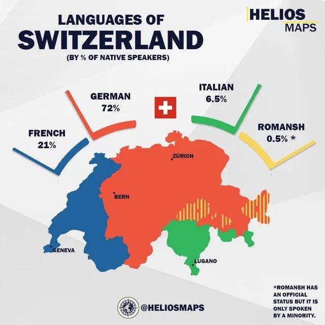
1. German - 72%
2. French - 21%
3. Italian - 6.5%
4. Romansh - 0.5% https://t.co/klPQEjxbVg
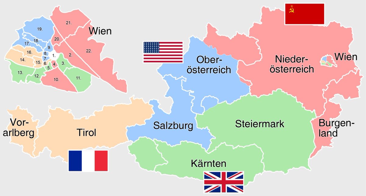
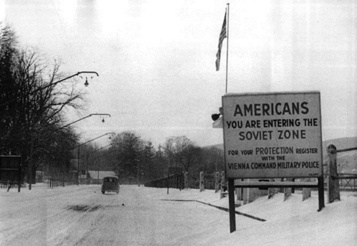
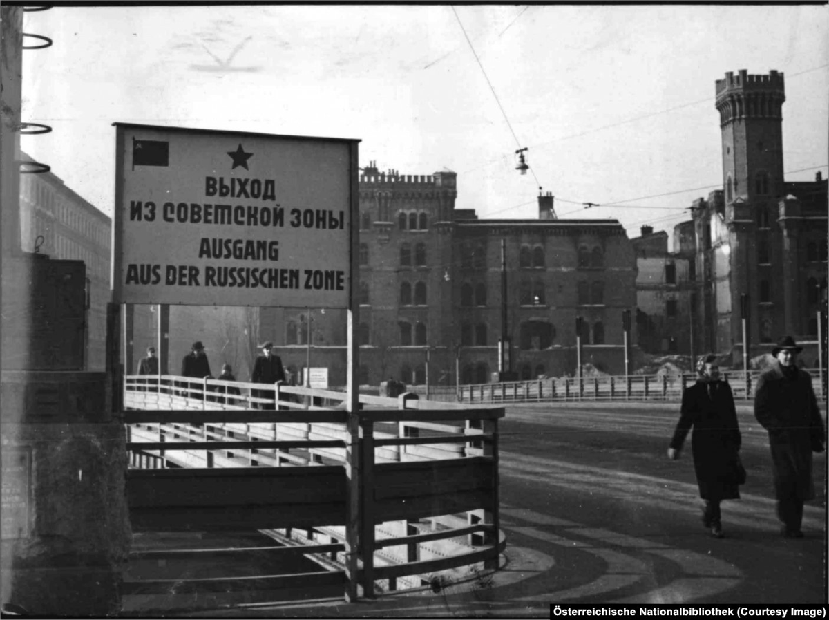
2⃣3⃣ At the border between Soviet-occupied Vienna and American-occupied Vienna (1950).
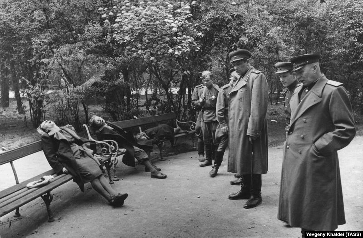
4⃣ Group of people who committed suicide when the Soviets arrived (1945). https://t.co/D3z2kINhD6
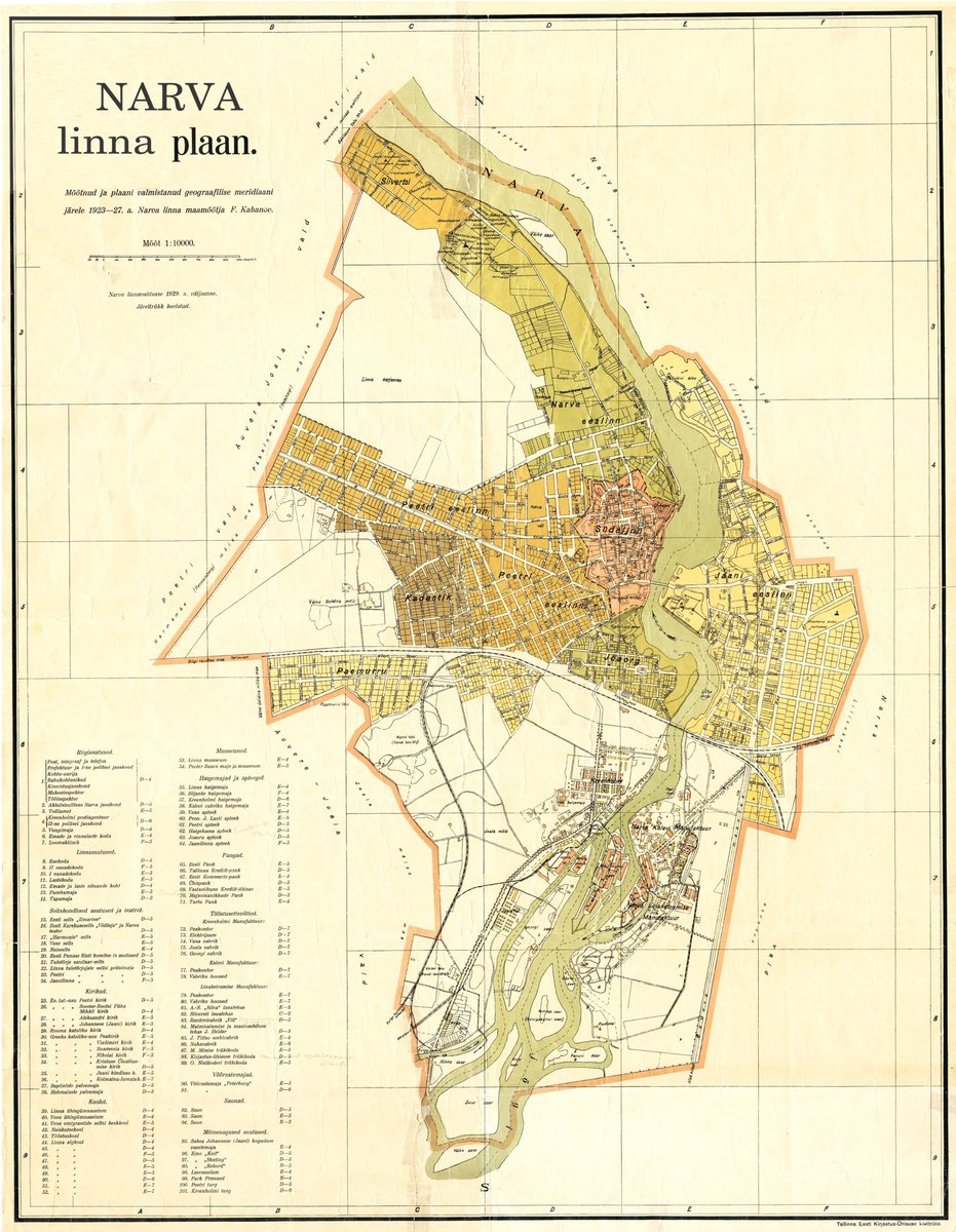
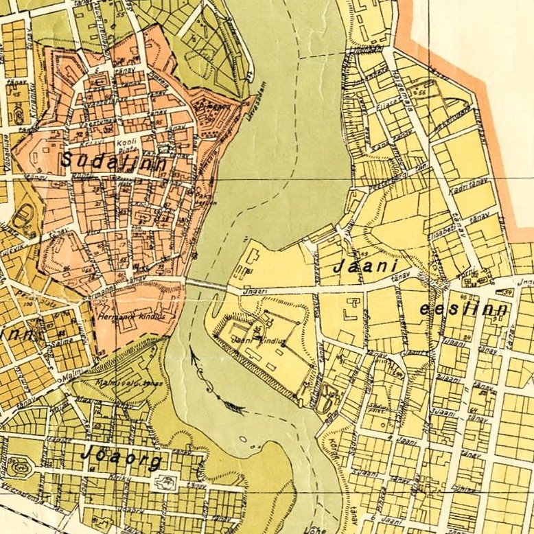
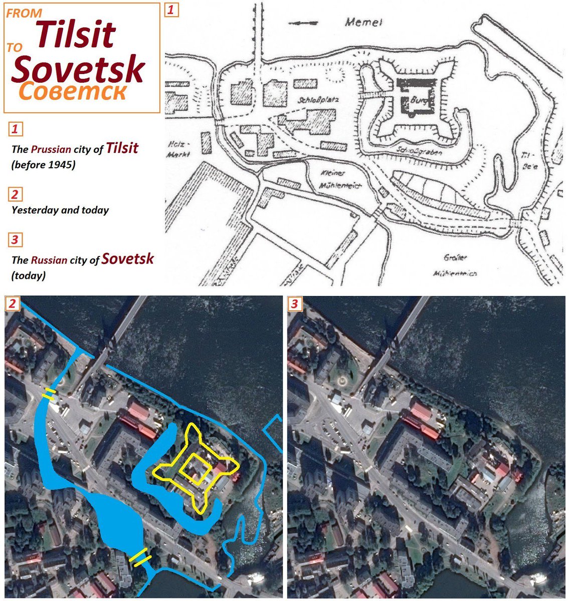
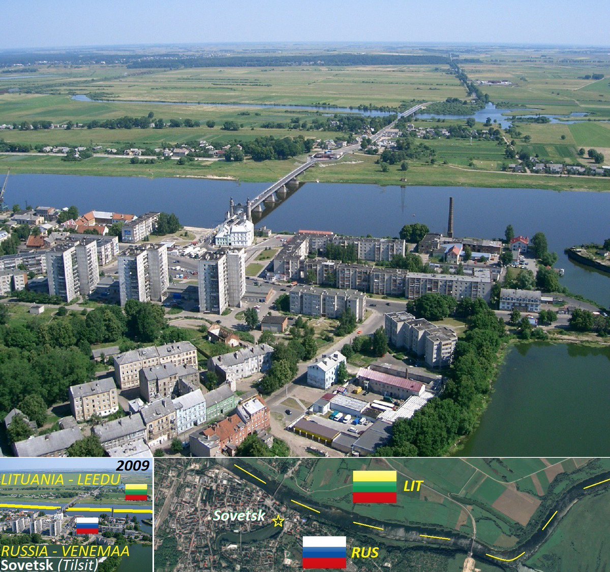
The Soviet occupation (1944–1991) led to the forced amputation of "Jaani eeslinn" (right of the river), which nowadays is still occupied by Muscovy.
🌐: 59°22'36.2"N 28°12'15.2"E.
🇪🇪 #Narva #Estonia #Jaanilinn https://t.co/c0mSzV5IWH
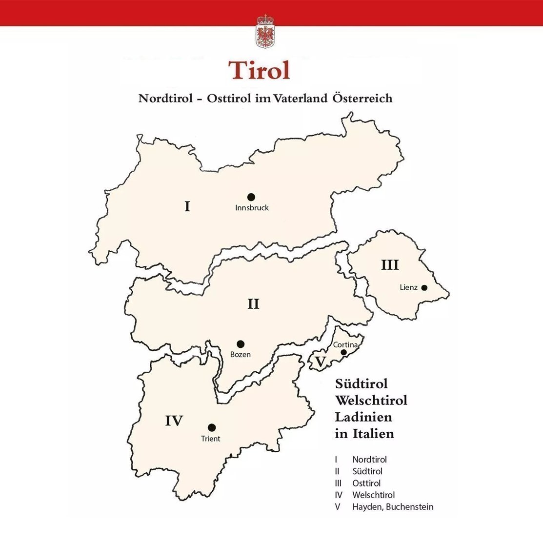
After the aspiration of uniting South Tyrol 🇮🇹 with Tyrol 🇦🇹 and East Tyrol 🇦🇹, they would also like to annex Trentino 🇮🇹 and Cortina d'Ampezzo 🇮🇹.
#Tirol #AltoAdige #Trentino #Cortina #Innsbruck #Bolzano #Trento https://t.co/rpU8LcmTHd
On the opposite bank of the river, Lithuania 🇱🇹 has returned since 1990. https://t.co/DEzVon7wjk
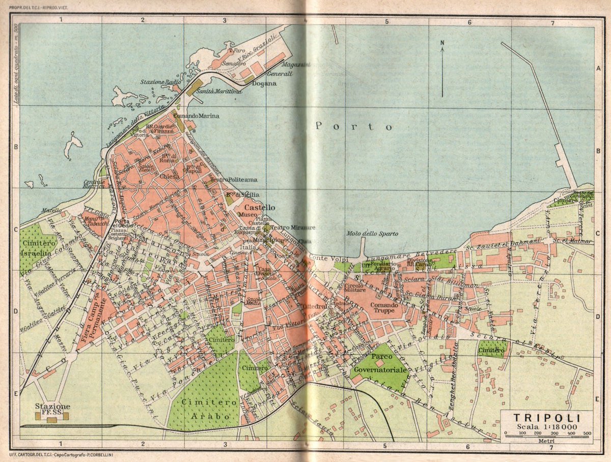
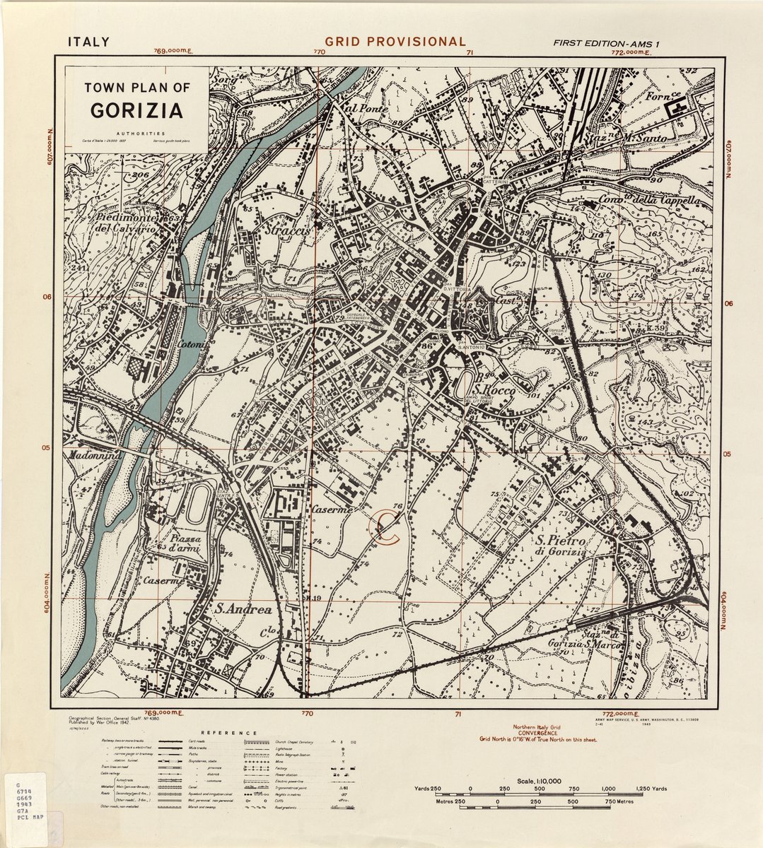
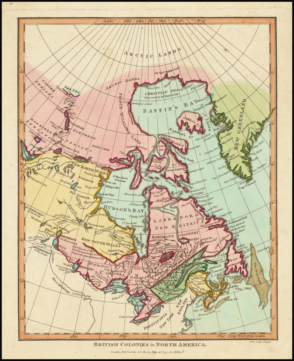
High definition image. Zoom in to read street names and major locations. https://t.co/zuVjgbJOid
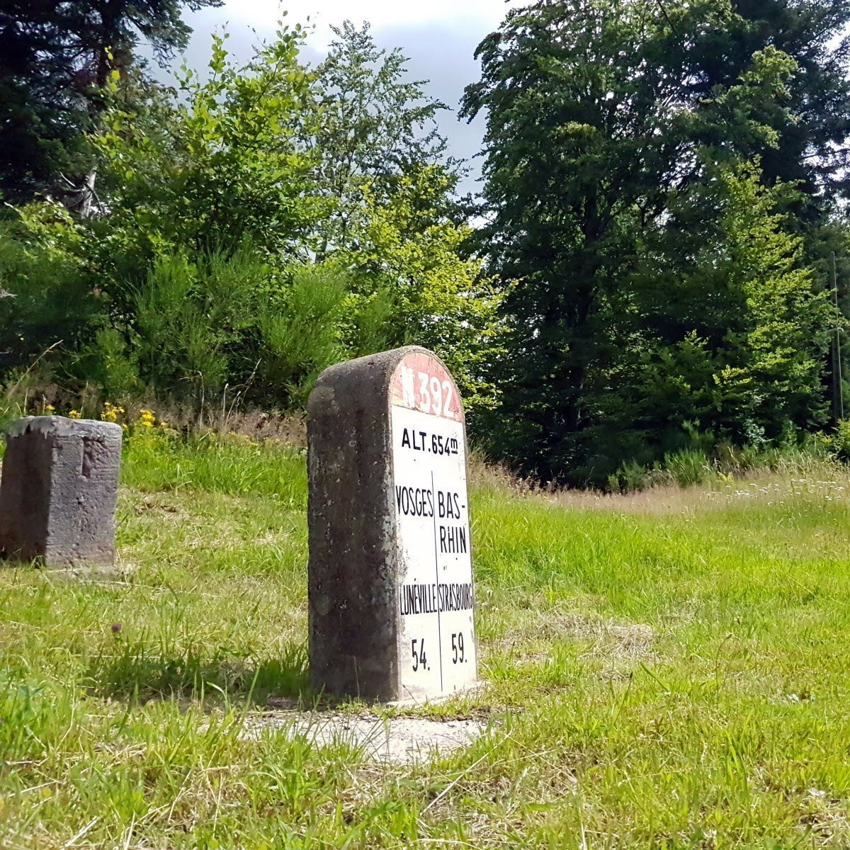
1⃣ Stones of the ancient France-Germany border (1871-1919, furthest left) and of the current French border between the Vosges Department and the Bas-Rhin Department (centre).
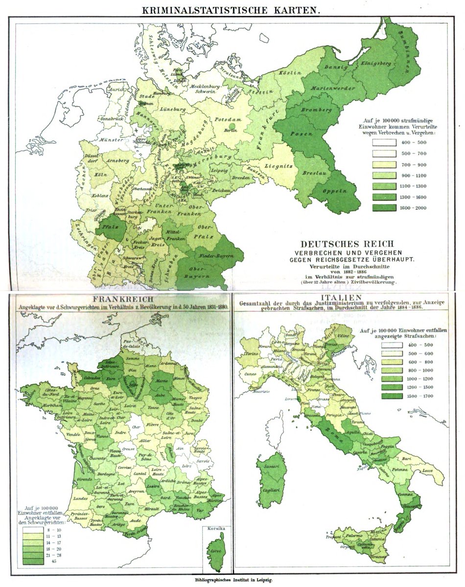
2⃣ Crime maps; convicts in relation to the population, in Germany, France and Italy (1882–1886). https://t.co/4fOdPs2HGA
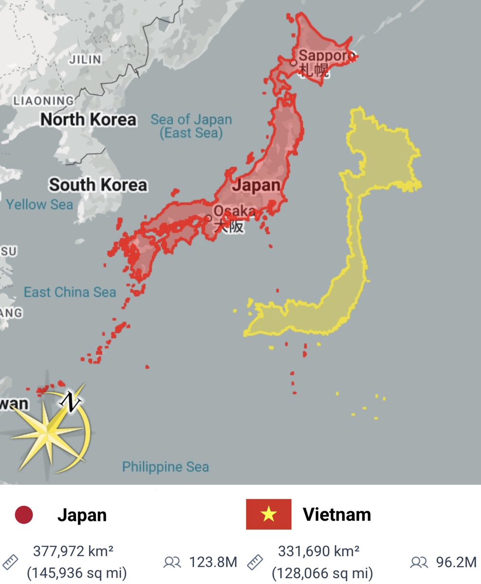
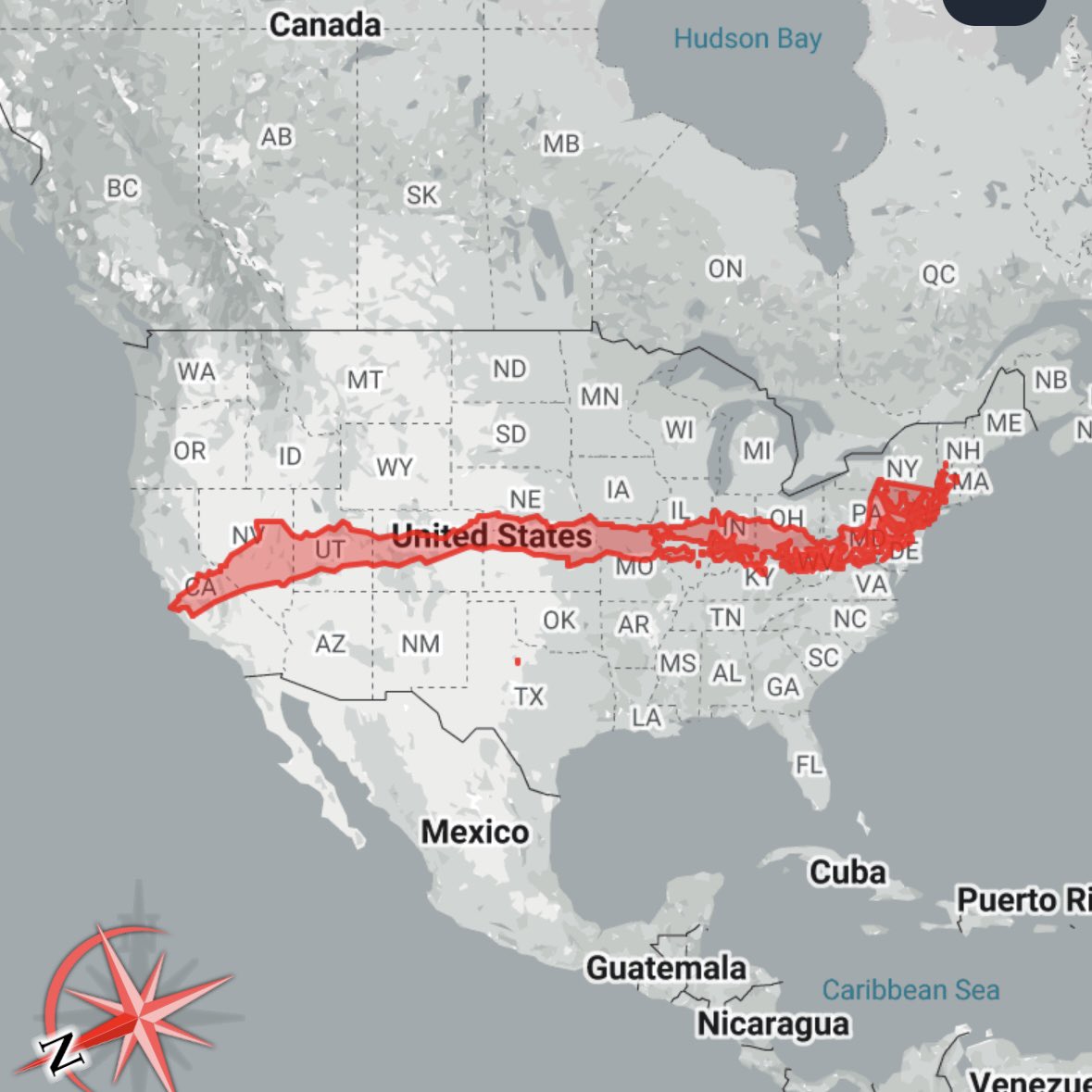
This shrinks it down to true scale.
It's still the largest country on earth by land area. This is just another example of how badly the Mercator projection distorts our maps. https://t.co/EF5fl4INDn
Dimensions: 3162x3518 pixels.
#Gorizia #Gorica #Görz https://t.co/PVTDdeie9l
Riigipiirid - Confini - Borders - 国境 - 边界 - Meje - Robežas - Sienos - Кордони - Granice - Grenzen - Mpaka - Fronteiras - Fronteras - Perbatasan - Frontières
Geography trivia with a side of history | Test your knowledge & learn about the world! | Maps, visuals, & interesting facts | By Brian Thudium
Bold truth-seeker | Passionate about history, crime & Americana | Old maps, ancient & naval history admirer | Historical books a must | 100% American 🇺🇲
Global Ranking || Facts || Wealth || Culture || Maps || Economy || Statistics & Data @Theindexinsider
No reviews yet
Be the first to share your experience!
Share Your Experience
Sign in with X to leave a review and help others discover great communities
Login with XLoading...
Share your best (and worst) maps in our new community